Eye-tracking in uncertainty visualization
Jan Brus
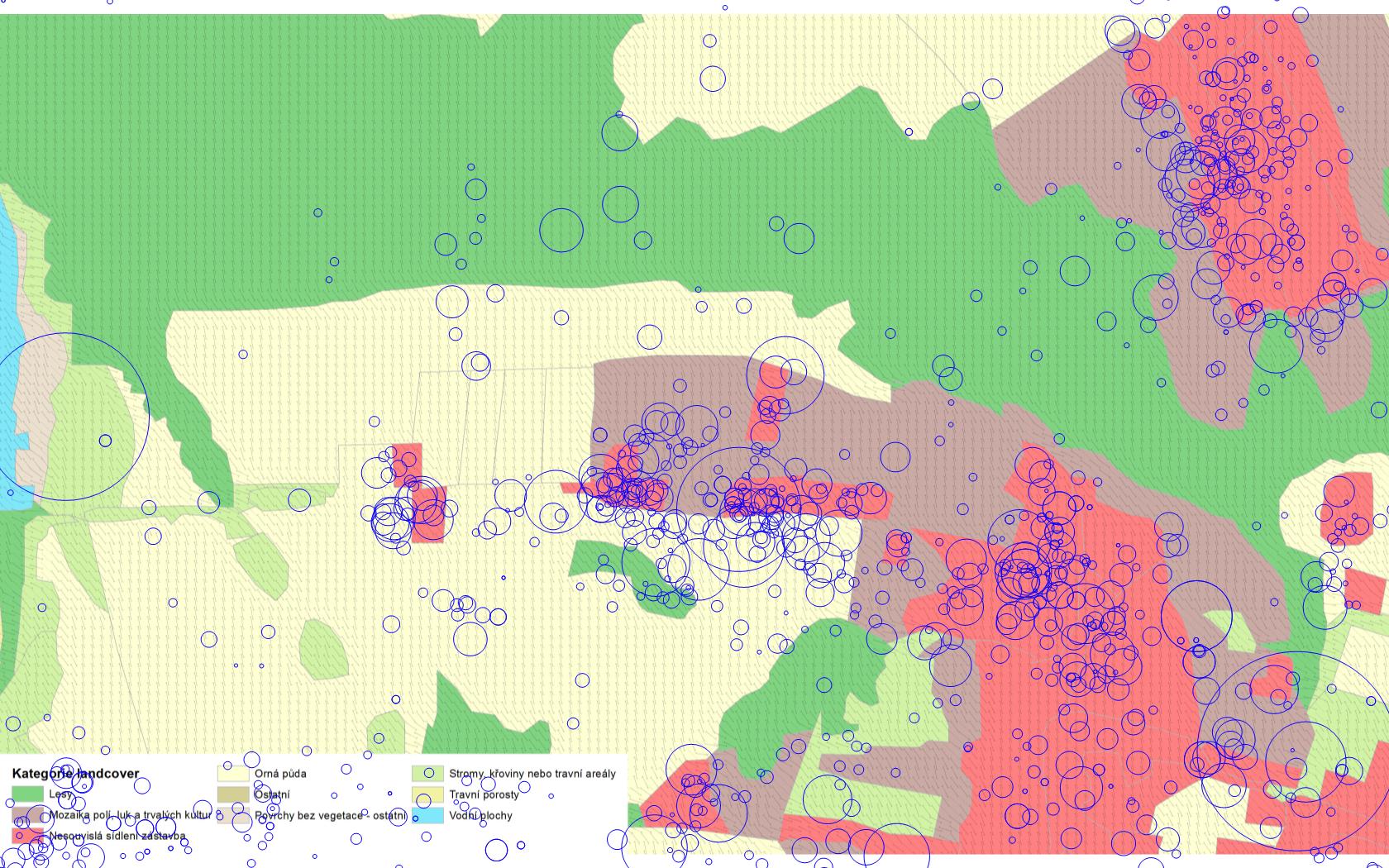
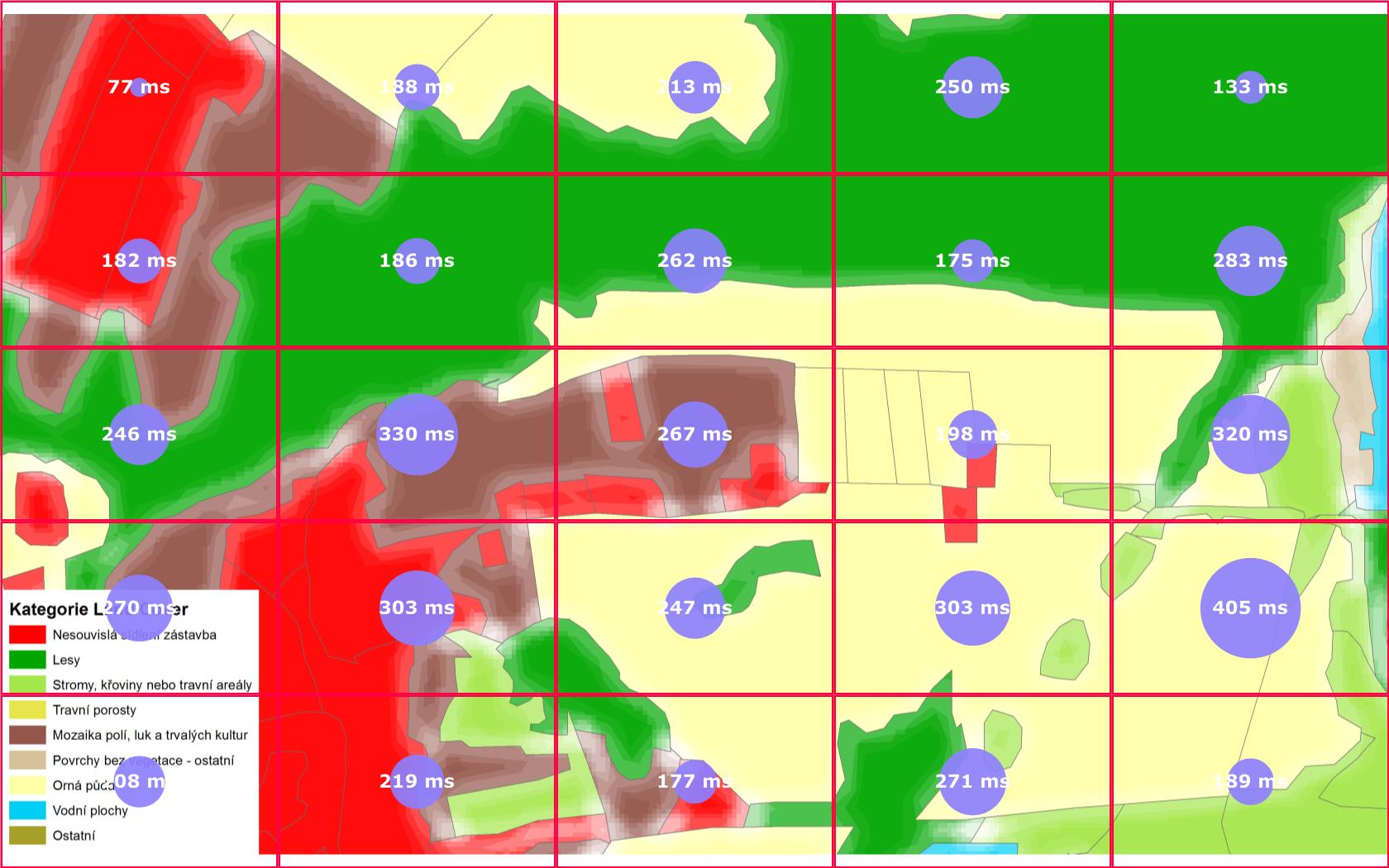
Any decision can only be as good as the quality of the information above which it is decided. If we are talking about real environmental data, including simulated data, the uncertainty is an undeniable part of everyday life. Uncertainty arises from the essence of natural processes and their variability. That is why the subsequent modelling and visualizations of these processes cannot be made without a certain degree of approximation. Cartographers deal with the problem of displaying uncertainty for a very long time. In most cases, the uncertainty in the process of cartographic processing is ignored mainly due to the assumption that the user will not be able to perceive map limitations caused by this very abstraction. Maps are usually considered as an imaginary pillar of objectivity and truth, which results in a sense of confidence of all users of these maps. For maps showing the earth’s surface, which are very general, positional error almost does not play any role in real life. Thus for many applications is acceptable to use the map with a large number of hidden uncertainty. Equally for effective communication it is rather necessary. However, a problem arises when others professionals using these cartographic works as a basis for their decision support begin to be interested in the results of these analyses. Then the uncertainty contained in the map gets to the forefront and makes crucial information. Visualization of uncertainty of spatial data includes a wide range of issues relating to data quality of the individual components, their definition, nature, database design, graphic methods, selection and implementation, dynamic monitoring and description of the error propagation in GIS operations, and many more. It follows that it is necessary to explore, extend and integrate existing research in uncertainty visualization of spatial data in environmental studies, particularly in the Czech Republic, where the topic was not developed so much. More precisely there are only a few departments which have been interested in this field more in detail. Several visualization techniques for the portrayal of uncertainty have been developed, but there is a gap in transferring knowledge between researchers and final users due to the lack of knowledge about the effectiveness of these visualizations. The verification new methodology, new metohods and also for testing used methods new tests are conducting using eye-tracking. Eye-tracking can help to understand questions concerning the user’s strategy of the information searching. To assess graphic effectiveness, eye-tracking methods can help to provide a deeper understanding of scanning strategies that underlie more traditional methods.
SELECTED PUBLICATIONS
Brus, J., Popelka, S., Brychtová, A., Svobodová, J. (2012): Exploring Effectiveness of Uncertainty Visualization Methods by Eye-Tracking. Symposium proceedings Accuracy 2012, 10th International Symposium on Spatial Accuracy Assessment in Natural Resources and Environmental Sciences Florianópolis, SC, Brazil, 215-221s.