Eye-tracking group in Olomouc
The Department of Geoinformatics at Palacký University Olomouc conducts research in cartography and geographic visualization, with a strong focus on cognitive visualization and eye-tracking. Our work addresses the long-standing lack of objective methods for evaluating maps and cartographic products.
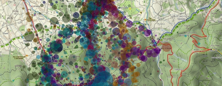
We apply eye-tracking and cognitive science to understand how users perceive, interpret, and interact with maps. By combining experimental methods with cartographic theory, we aim to evaluate and optimize geographic visualizations.
Our team consists mainly of early-career researchers working on topics such as map complexity, cartographic interactivity, 3D visualization, map-reading strategies, and gaze-based interaction—all driven by a single goal: to create better, more effective maps.
Beyond cartography, we collaborate with scientists from psychology, mathematics and science education, religious studies, linguistics, media studies, and sociology. We also provide applied research and user testing services to commercial partners through the Competence Center ETEBOR, supporting the transfer of research into practice.
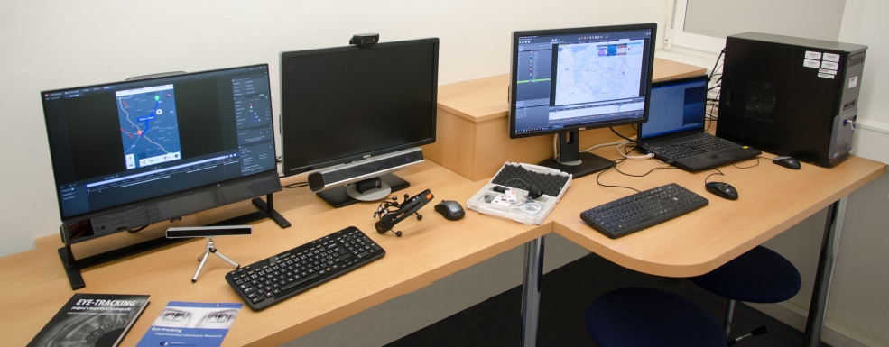
The laboratory is equipped with a wide range of eye-tracking, EEG, and physiological measurement technologies, including stationary and mobile eye-trackers, EEG, and GSR sensors. Data analysis is performed using established software tools and our own solutions, such as ScanGraph and GazePlotter.